

Geography Home

Watch the College of Natural Resources and Environment's 2025 Spring Commencement
Congratulations, CNRE graduates!
In the Spotlight
-
Article Item
 Study abroad in New Zealand , article
The Department of Geography offers an experiential learning opportunity each year to spend the three weeks of winter term in New Zealand.
-
Article Item
 Geography faculty offer expertise about Olympics , article
Meteorology Assistant Professor Craig Ramseyer is one of two Department of Geography faculty members offering expertise about issues faced in the Paris Olympics.
-
General Item
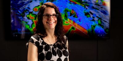 Stephanie Zick is podcast expert guest
Meteorology Assistant Professor Stephanie Zick was the expert guest on two podcasts focusing on the weather.
Geography News
-
Article Item
 Virginia Tech researcher finds AI could help improve city planning , article
The new research shows that using generative artificial intelligence such as ChatGPT and Google’s Gemini could improve city planning by enhancing access to tools that help measure walkability, safety, lighting, and more.
Date: Oct 30 - -
Article Item
 Students engineer solutions in remote corners of the world , article
Virginia Tech students learned about water quality in the remote Himalayan mountains of Nepal during a three week long trip to improve irrigation.
Date: Oct 07 - -
Article Item
 Researchers seek to better understand population mobility in the Indo-Pacific , article
A research team led by Anamaria Bukvic in the Department of Geography received a $2 million grant from the Department of Defense to evaluate how efforts to adapt to climate change affects population mobility in coastal areas in the Indo-Pacific.
Date: Sep 10 -
Stories from Geography
-
Article Item
-
Video ItemVisualizing highway safety , video Date: Jun 18, 2025 -
-
Article Item

